
When it comes to hiking near Boone, the options can seem unlimited. Do you want a summit hike? Want to see a waterfall? How about something off the beaten path? There’s a hike for everyone.
But what about kids? Are there hikes near Boone for families with young kids? Hands down… yes.
When you're looking for the best hikes in Boone for families, it all comes down to what you're looking to get out of your hike. Which is why I've noted why you may do each of these hikes in Boone. Keep reading, and find the best hike for you and your family!
So what are the best hikes in Boone for kids?
- Price Park Picnic Area and Boone Fork Trail… Best for Creek Play and Scavenger Hunts


- Price Lake Loop Trail… Best for Lake Wading
- Boone United Trail… Best for Proximity to Downtown

- Junaluska Park… Best for Nature With a Playground
- Elk Knob Kids Track… Best for a Peaceful, Easy, Less Populated Track
- The Cascades Trail… Best for Creek Play and a View
- Otter Falls… Best for Playing in Small Falls
- Sims Pond/Green Knob Trail… Best for a Magical Forest with Creek Play
- Flat Rock… Best for a Short Hike with a View
- Grandfather Mountain - Bridge Trail to Grandfather Trail… Best for a Tourist Destination
- Grandfather Mountain - MacRae Peak… Best for an Adventurous Family
- Goshen Creek... Best for Off-the-Beaten-Path Creek Play
= You may get wet!
= Within (approximately) 20 minutes of downtown Boone**
= Remains open in the winter
**For the sake of this post, I’ve marked all “distance from downtown” notes to be from Wild Craft Eatery. First of all, because it is a part of downtown. Second of all, because it’s delicious and you should eat there 
If you're looking for more things to do in Boone with kids other than hike, you may be interested in these articles:
If you're looking for a place to stay in Boone, my new favorite tool is Booking.com. Yes - I think it has finally surpassed Airbnb on my travel planning top ten list! 😲
Why? Booking.com offers a mix of hotels and rental properties. Many of them have free cancellation policies. Cleaning fees are included in the price you see!
Pro tips for using Booking.com:
If you book through their app, you'll often get an additional "mobile only" discount.
Create a free account and get an additional 10% off certain stays with their "genius" discount.
Once you click on a property, be sure to look below the bolded price. It will show you how much will be added for taxes!
Price Park Picnic Area and Boone Fork Trail
- Best Hike in Boone for: Creek Play and Scavenger Hunts
- Distance from downtown Boone: 11.7 miles (approximately 20 minutes)
- Location according to Google: “Price Park Picnic Area”
- Bathrooms? Yes
- Picnic Tables? Yes
- Total Distance: 5.2 miles (So we usually just do an out and back, but on a weekend when we have plenty of time, we would attempt the full loop!)
- Elevation Gain: 528ft (If you do the whole loop)


Description:
Just off the parking lot, you cross a bridge, and there is a nice, wide spot for creek play. We did see some water snakes in the creek one day. So we just let them be, and they moved on.
If you continue on into the field, you’ll find a sign for kids. There are usually two different brochures that have nature scavenger hunts available for kids. They are a great way to engage kiddos in the hike while teaching them (and you!) a thing or two about your surroundings.
If you keep going past the field, you enter the forest. It’s a single track with quite a few roots. I personally like this “rugged” type of trail, as it makes it feel more like a “hike” than just a walk in the forest.
Depending on water levels, there may be a few minor water crossings, so wear the right shoes!
What I love most about this trail is the variety. You could really spend all day here playing in the creek, doing the scavenger hunt, having lunch, going for a hike in the forest, playing in the creek some more, etc...
*Note that this trail is located along the Blue Ridge Parkway, so may be closed during certain parts of winter.
Price Lake Loop Trail
- Best Hike in Boone for: Lake Wading
- Distance from downtown Boone: 11.8 miles (approximately 20 minutes)
- Location according to Google: “Price Lake Parking Lot”
- Bathrooms? No, but Price Lake Picnic Area is a short hop away if you’re in desperate need of a restroom before or after your hike
- Picnic Tables? No
- Total Distance: 2.2 miles
- Elevation Gain: 72ft


Description:
Price Lake Loop Trail is an easy, flat track that circles around Price Lake. There are plenty of areas to wade and play in the lake. So many, in fact, that we rarely make it all the way around, simply because we get distracted playing so much!
There are also some areas that are fun for climbing on rocks and other types of naturey play.
It is a pretty popular trail, but the wider track can handle the traffic.
There are also areas around the lake to rent kayaks and SUPs. So between the hike and some time on the lake, you could have yourself a pretty full day in nature.
*Note that this trail is located along the Blue Ridge Parkway, so may be closed during certain parts of winter.
Boone United Trail
- Best Hike in Boone for: Proximity to Downtown
- Distance from downtown Boone: 1.5 miles (approximately 5 minutes)
- Location according to Google: Boone United Trail
- Bathrooms? No
- Picnic Tables? Yes
- Total Distance: 2.2 miles Roundtrip
- Elevation Gain: 639ft if you do the entire trail


Description:
When looking for this trail, it’s important to note that you’ll be parking in the back of the parking lot at Boone United Methodist Church. So when your navigation takes you to the church, you’re in the right spot.
Boone United Trail is a “lollipop” shape. You go up, do a loop at the top, and come back down the same way you went up.
When you first start on the trail, there is a nice area for some creek play that is near the picnic shelter. This makes for a great play area for the kids while you set up and eat some lunch.
After the picnic shelter, you follow a flat trail to where you’ll cross that same creek again. After crossing the creek, you’ll land in a field that almost looks like someone’s backyard. You’re still in the right spot. Hug the creek, and you’ll come to another bridge that crosses the creek and leads up some stairs.
These stairs mark the beginning of your climb. For such a short trail, there is some decent elevation gain involved. The kids don’t usually seem to mind. And plus, on the way back, you’re going downhill.
There are often deer to be spotted. And it’s just a nice escape to nature without having to go too far out of town. There are no lookouts or waterfalls, but I’d still highly recommend this trail for a good family hike in Boone.
Junaluska Park
- Best Hike in Boone for: Nature with a Playground
- Distance from downtown Boone: 0.4 miles (approximately 2 minutes)
- Location according to Google: “Junaluska City Park”, or “Watauga American Legion” for more ample parking
- Bathrooms? Yes
- Picnic Tables? Yes
- Total Distance: Unknown, but short
- Elevation Gain: Unknown, but flat


Description:
This park has a grassy field for sports play, a playground, and a few short trails through the forest behind the playground.
Note that the playground isn’t the best for babies and toddlers. It’s meant more for the preschool and up ages. There would be some things for toddlers, but everything is bigger and taller, and it only has “big kid” swings.
There isn’t a ton of parking if you follow directions to “Junaluska City Park”. So instead, follow directions to “Watauga American Legion”. There’s a bigger parking lot, which is actually meant for Junaluska as well.
The trail is short and easy, but enough of a trail to get your “nature” fix. Plus, it’s incredibly close to downtown if you’re already in the area.
Elk Knob Kids Track
- Best Hike in Boone for: A Peaceful, Easy, Less Populated Track
- Distance from downtown Boone: 11.1 miles (approximately 20 minutes)
- Location according to Google: Elk Knob State Park (then follow signs for “Trailhead parking”)
- Bathrooms? Yes (mid-hike)
- Picnic Tables? No
- Total Distance: 1 mile
- Elevation Gain: Unknown, but flat


Description:
This easy trail is perfect for kids. It is relatively flat, and a good distance that kiddos can easily walk on their own. There are bathrooms midway through the trail. Some artwork to check out along the way. And even a teepee made of branches toward the end that kids always love.
Sometimes, there are pamphlets with kid’s nature scavenger hunts at the trailhead, much like at Price Park Picnic Area. This could be fun for older kids, or for learning about what you’re seeing along the trail.
It is so peaceful up there, which I really appreciate. A lot of the trails along the Blue Ridge are busier with people, and usually have some sort of road noise. Not up at Elk Knob. If it weren’t for excited, chatting kids, the only sounds up there would be the singing birds and rustling of leaves.
A quick note on temperature. It is always cooler up at Elk Knob. Not only due to the elevation, but also because most of the trail is tree-covered. This could either be a positive or a negative depending on the time of year. Just make sure you’re prepared.
Elk Knob also has an option for a 1.9 mile summit hike. I’ve yet to check it out, but if you’re looking for more of a challenge, it’s the more popular trail in the park.
Cascades Falls
- Best Hike in Boone for: Creek Play and a View
- Distance from downtown Boone: 15.6 miles (approximately 25 minutes)
- Location according to Google: “E.B. Jeffress Park - The Cascades Trail”
- Bathrooms? Yes
- Picnic Tables? Yes
- Total Distance: 1.6 miles Roundtrip
- Elevation Gain: 108ft


Description:
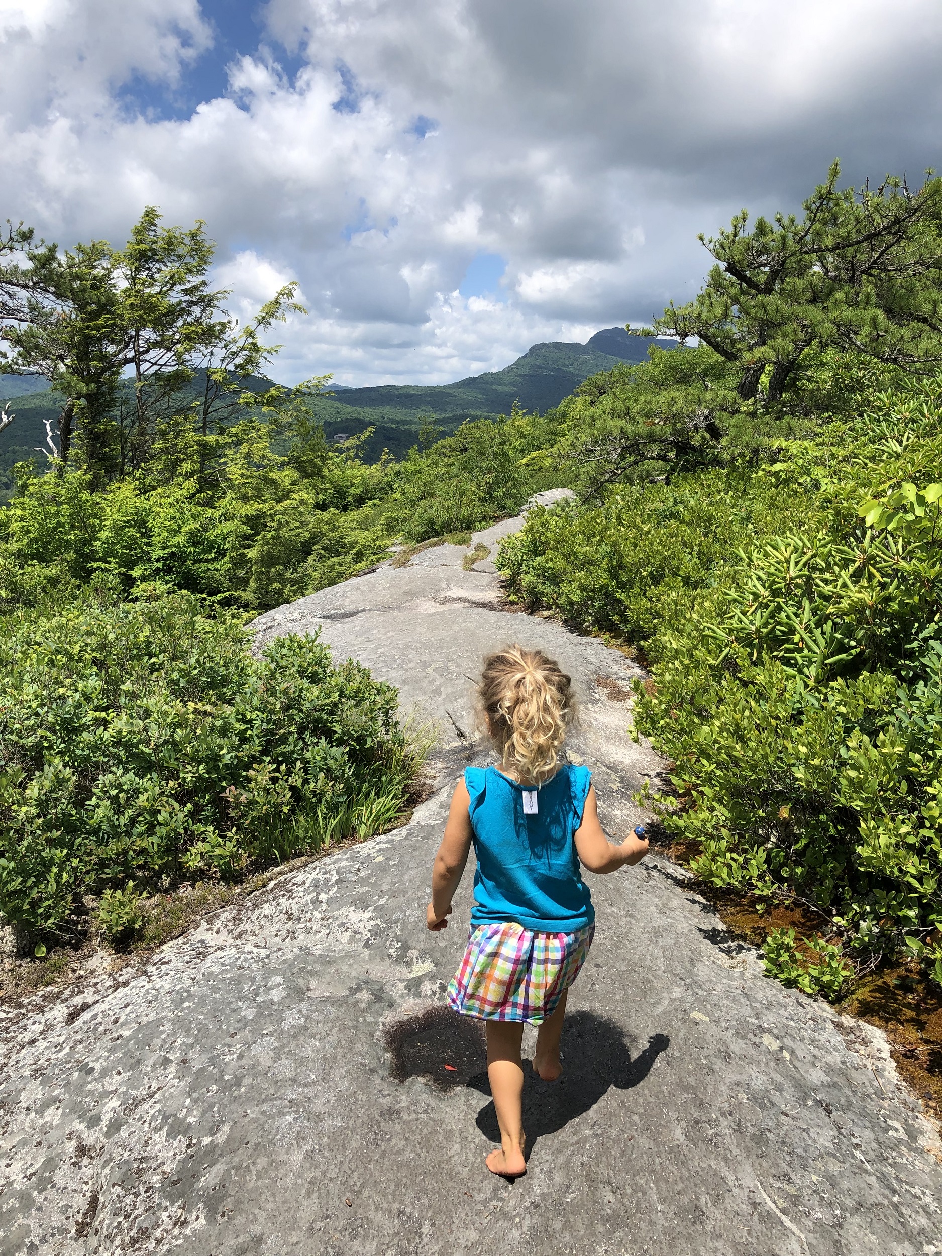
The Cascades Trail is a one-way trail, ending at Cascades Falls. The falls have a nice lookout area, but it definitely isn’t a water play spot. It’s a stop, look, take a photo, and leave kind of spot.
That being said, the trail there and back has numerous creek play spots that kids could spend hours in… just make sure you bring some towels and a change of clothes! (See the photo above)
The trail is pretty easy and flat. Near the end, when you’re approaching the falls, there are some steep steps. So if that isn’t something you can handle with kiddos, I wouldn’t plan on going all the way to the falls.
The trailhead parking lot has fantastic views of the Blue Ridge Mountains, and makes for the perfect spot to sit at a picnic table and enjoy some lunch after your hike.
*Note that this trail is located along the Blue Ridge Parkway, so may be closed during certain parts of winter.
Otter Falls
- Best Hike in Boone for: Playing in Small Falls
- Distance from downtown Boone: 12.1 miles (approximately 20 minutes)
- Location according to Google: “Otter Falls Trail”
- Bathrooms? No
- Picnic Tables? No
- Total Distance: 1.2 miles Roundtrip
- Elevation Gain: 226ft


Description:
Otter Falls Trail features an easy, wide track down to Otter Falls. Keep in mind, that I said “down” to the falls. That means that on the way back, you’ll be walking up. It isn’t anything too crazy, but just be prepared if kiddos are going to have tired legs.
You can get a little turned around on the way down, so take a photo of the trail map before you leave the trailhead. But in general, if you go down on the way there, and up on the way back, you should be fine.
This trail is more about the destination than the journey. The falls are nothing spectacular or grand, but they provide a lot of opportunities for rock and stream play.
Although there isn’t a picnic area, you should probably pack a lunch to spread out on one of the boulders near the falls.
There is a more difficult trail that goes upstream, and supposedly loops back around to the other side of the falls. In our experience, though, that trail eventually ended. It was still fun to check out and explore a part of the falls that is less popular.
*Note that, although not on the Blue Ridge Parkway, the town of Seven Devils reports that this trail could close in the winter.
Sims Pond
- Best Hike in Boone for: A Magical Forest with Creek Play
- Distance from downtown Boone: 11 miles (approximately 20 minutes)
- Location according to Google: “Green Knob Trailhead”
- Bathrooms? No (but close to Price Park Picnic Area)
- Picnic Tables? No
- Total Distance: 2.3 miles
- Elevation Gain: 538ft


Description:
“Magical” is really my best description for this trail. Sure, at the beginning, there is a man-made pond for wading. But the real magic begins as you enter the forest. Tall trees, mossy rocks, and creeks for little ones.
In full disclosure, I have yet to complete this loop! We usually get way too distracted with all the fun that’s to be had along the way, ha!
Certain parts of the trail can be a bit more technical. Some large steps and steep trails. Roots and rocks, etc. Nothing crazy, but some little ones may need a bit of assistance along the way.
*Note that this trail is located along the Blue Ridge Parkway, so may be closed during certain parts of winter.
Flat Rock
- Best Hike in Boone for: A Short Hike with a View
- Distance from downtown Boone: 19.5 miles (approximately 30 minutes)
- Location according to Google: “Flat Rock Loop Trail”
- Bathrooms? No
- Picnic Tables? 1 - Though it is between the parking lot and the Blue Ridge Parkway, so a potential hazard for wandering feet!
- Total Distance: 0.7 miles
- Elevation Gain: 137ft


Description:
This short trail takes you up to an opening in the forest where there are… you called it… flat rocks. But these flat rocks not only make for a perfect viewing spot over the Blue Ridge Mountains, but also make a perfect lunch spot and play area for the kids.
The way there is all up, and the way back is down. But it really isn’t much elevation gain. When we were there in the summer, there was quite a bit of poison ivy along the side of the trail. So wandering hands beware!
*Note that this trail is located along the Blue Ridge Parkway, so may be closed during certain parts of winter.
Grandfather Mountain - Bridge Trail to Grandfather Trail to Grandfather Trail Extension
- Best Hike in Boone for: A Tourist Destination
- Distance from downtown Boone: 21.2 miles (approximately 40 minutes)
- Location according to Google: “Grandfather Mountain Hiker Parking”
- Bathrooms? Yes
- Picnic Tables? No
- Total Distance: 1.2 miles
- Elevation Gain: 377ft


Description:
A quick note about Grandfather Mountain: There is an entrance fee to get into the park. Check here for current pricing.
This trail takes you on a short hike up to the famous Mile High Swinging Bridge. Don’t worry, by “mile high”, they mean in elevation… not a drop distance. In fact, the distance from bridge to ground is only 80ft.
Yes, you can drive all the way up to the Swinging Bridge, but the hike is definitely worth it. The kids have fun climbing up the rock “steps”. And you feel like you really deserve the reward of the views at the top when you get there. And the views really are spectacular.
Do you have to deal with tourists being tourists? Sure. But it’s a fun destination, and something that you kind of have to do at least once. So snap your photos, sit down for a snack, and take in the views.
In the parking lot, there is a portajohn. And at the top by the bridge, there is a proper bathroom inside the giftshop.
There is always someone directing traffic in the parking lot, and they’re happy to provide a map and direct you to the trail.
The hike back along Grandfather Trail and Grandfather Trail Extension is really the highlight of this hike, though. You’re rewarded with fewer crowds, a bit more peace, and spectacular views as you descend your way down to the parking lot.
To get to it, you’ll cross the parking lot that is up by the bridge. You’ll see a trail sign with a map that marks the entrance to the trail. Follow signs for “Grandfather Trail”.
Just make sure you turn off when you get to the “Grandfather Trail Extension”, or your hike may turn into an all-day event 🙂 Don’t worry, the signage is pretty obvious, and the turnoff is pretty hard to miss.
You can access the trail map before your trip here.
Grandfather Mountain - MacRae Peak
- Best Hike in Boone for: An Adventurous Family
- Distance from downtown Boone: 21.2 miles (approximately 40 minutes)
- Location according to Google: “Grandfather Mountain Hiker Parking”
- Bathrooms? Yes
- Picnic Tables? No
- Total Distance: 2.5 miles-ish
- Elevation Gain: 1142ft


Description:
Don’t let the shorter distance of this hike fool you. It is pretty involved. We usually hike with kids at a pace of about 1 mile per hour. On this trail? It took us double that. So, two hours for every mile!
Taking kids on this trail turned out to be a bit controversial in the online world. A lot of adults were projecting their own fears and limitations on what they think the limitations of children are.
There ARE ladders… Playgrounds have ladders. There are ropes to help you climb up steeper rock sections… Playgrounds have the same thing. There are rocks to scramble over… Sounds like an obstacle course to me!
Yes, there were more “challenging” sections of this hike. But honestly? That’s sometimes what keeps kids interested! We never once felt like the trail was dangerous. If we did, we would not have hesitated to turn around. It was simply a fun family adventure.
All that being said… This trail was spectacular… and FUN! And the views from the top were phenomenal. If you’re up for an adventure, do this trail.
To get to it, park in the Grandfather Mountain Hiker Parking lot. But don’t follow everyone up to the Swinging Bridge. Though you could tie that in if you’d like. It would just add a bit of distance.
Instead, head to the trail on the other side of the parking lot, near the portajohn. Hike up the Grandfather Trail Extension. When you get to Grandfather Trail, going left takes you to the Swinging Bridge. To get to MacRae peak, go right.
Grandfather Trail will take you all the way to MacRae Peak. Once you soak in the views, head back along Underwood Trail, and back down Grandfather Trail Extension. You can check out the trail map here.
A quick note about Grandfather Mountain: There is an entrance fee to get into the park. Check here for current pricing.
Goshen Creek
- Best Hike in Boone for: Best for Off-the-Beaten-Path Creek Play
- Distance from downtown Boone: 5.5 miles (approximately 15 minutes)
- Location according to Google: Coordinates: 36.183521, -81.610708
- Bathrooms? No
- Picnic Tables? No
- Total Distance: 3 miles
- Elevation Gain: Unknown - but there is a bit of elevation change


Description:
This trail is a part of the MST trail, and definitely off the beaten track. Follow the coordinates to a spot where you park on the side of the road. It is pretty obvious where to park when you get there.
You will need to climb over a fence with an "MST" sign on it. You then walk under the Blue Ridge Parkway, across a small paddock, and over another fence on the other side. The trail begins there. Don't worry, the fence is meant to occasionally keep cows in... it isn't meant to keep you out!
After the fences, you're on the trail! It's always quite a bit cooler by the creek, for better or for worse depending on the season! On the trail, you'll enjoy unlimited creek play spots and a naturey trail with rocks and roots... so it isn't for someone unsure of their footing.
Eventually, the trail leaves the creek and undulates up and down a bit. It sticks pretty close to the Blue Ridge Parkway, so road noise is ever present in non-winter months. To be honest, though, with kids, we barely make it beyond about half a mile in! Too many creek play distractions, ha!
It's a beautiful spot to relax, enjoy nature, and to just let the kids play!
**See below for screenshots of where to find the parking for Goshen Creek Trailhead


If you want to have Goshen Creek literally in your backyard, you may be interested in staying at this rental property. I'm not sure if my kids would ever be convinced to leave this place to check out other hikes, though 😆
Have you done any of these hikes in Boone? If so, what are your favorites? Any I missed?
If you’re hiking with a toddler, be sure to check out Hiking with Toddlers: 7 Tips for Planning and Making it Fun.
And don't forget to check out these other articles all about what to do with kids in Boone:
Happy Hiking! 🙂